While we can’t eliminate the need for road construction, our cities are growing, and infrastructure needs maintenance, we can eliminate the chaos of the unknown.
At the recent Esri Canada User Conference, Daniel Kligerman Director for Intelligent Transportation Solutions from Esri Canada took the stage to highlight a collaborative solution developed with Raven Connected. It addresses a specific, frustrating slice of the congestion problem: unpermitted lane closures.
Watch the full 3-minute presentation here:
The Challenge: The Gap Between Permit and Pavement
Most major cities have robust digital systems for issuing permits. In Toronto, for example, contractors use a digital process (Ro-DARS) to log requests for lane closures. This creates a “perfect world” database of where construction should be.
However, anyone who drives knows that the database doesn’t always match reality.
- Sometimes a permit expires, but the pylons stay up.
- Sometimes a truck parks in a live lane without ever applying for a permit.
Until now, finding these discrepancies required manual patrols or reactive responses to citizen complaints.
The Solution: Interoperability in Action
This collaboration proves that the best solutions happen when technology partners play to their strengths.
- Raven Connected (The Eyes): Our onboard units can be deployed across municipal fleets creating a network of virtual inspectors within a city. They provide a constant stream of high-fidelity, road-facing imagery, capturing the “ground truth” of what is happening on the street.
- Esri Canada (The Context): Esri’s GIS technology provides the mapping and data analysis around a city and their permits.
By integrating these two systems, we bridged the gap between what should be and what actually is.
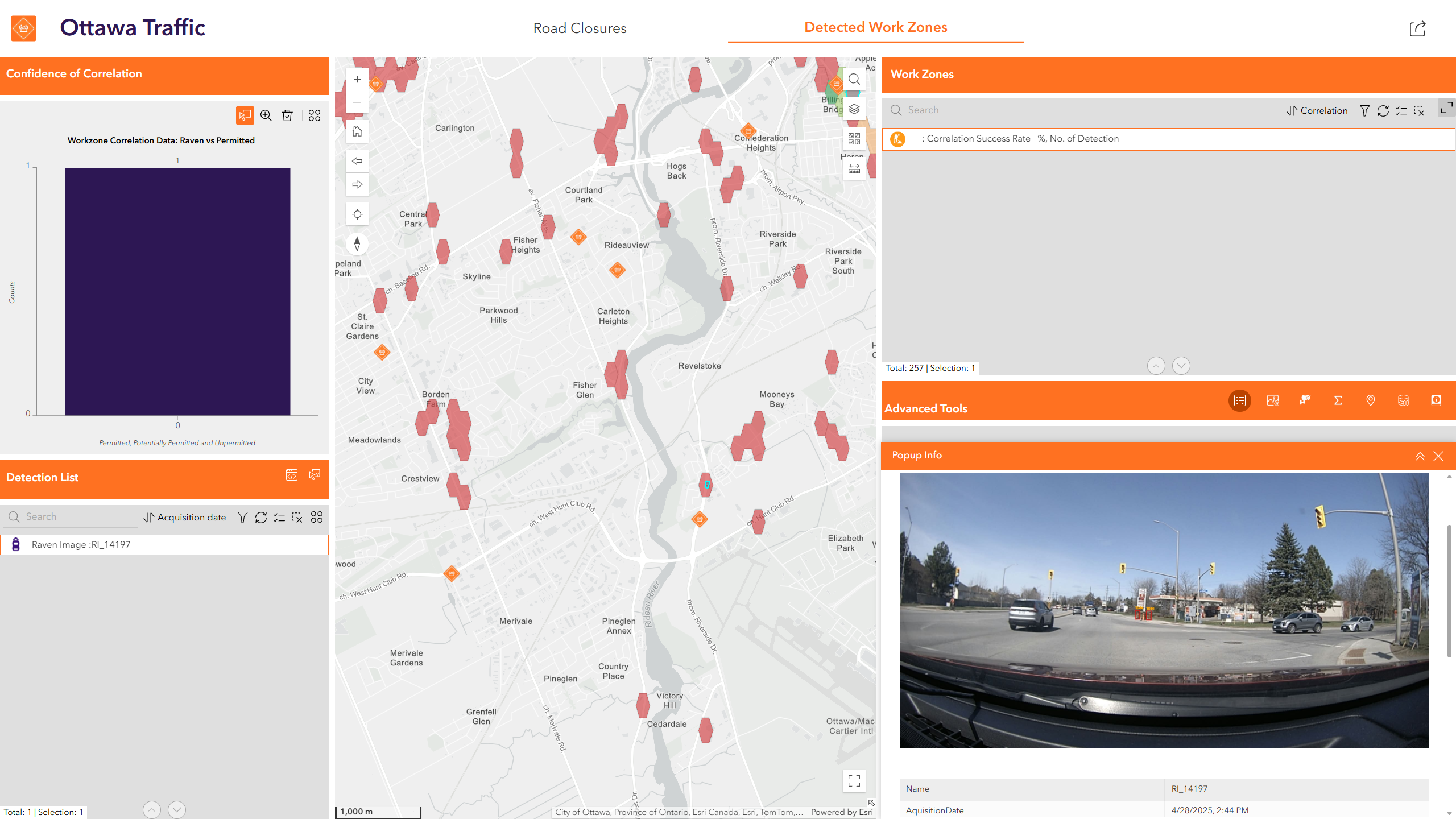
How It Works: Finding the “Red Polygons”
As Daniel demonstrates in the video, the solution correlates Raven’s visual detections with the city’s permit database in real-time.
- Verified Work Zones (Green): The camera detects construction, the system checks the database, and finds a valid permit.
- Unpermitted Closures (Red): The camera detects a lane closure (like the backhoe on Oriole Parkway shown in the video), but the system finds no matching permit.
The result is a red polygon on the traffic manager’s dashboard.
Why Partnerships Matter
No single company can solve the complexity of modern infrastructure challenges alone. This solution didn’t require building new hardware from scratch or reinventing the city’s database. It simply required interoperability.
By allowing our platforms to talk to each other, we transformed raw video data into a prioritized enforcement tool. Now, cities can focus their resources on clearing illegal obstructions and reclaiming road capacity for transit, cyclists, and commuters.
That is the power of the ecosystem. When we focus on what we’re best at, we deliver solutions that actually work. For more information or to leverage this solution for your city, contact gov@ravenconnected.com


Comments are closed